
Have you ever wondered how our growing population affects the picturesque landscape of the Delaware River Estuary and Basin?
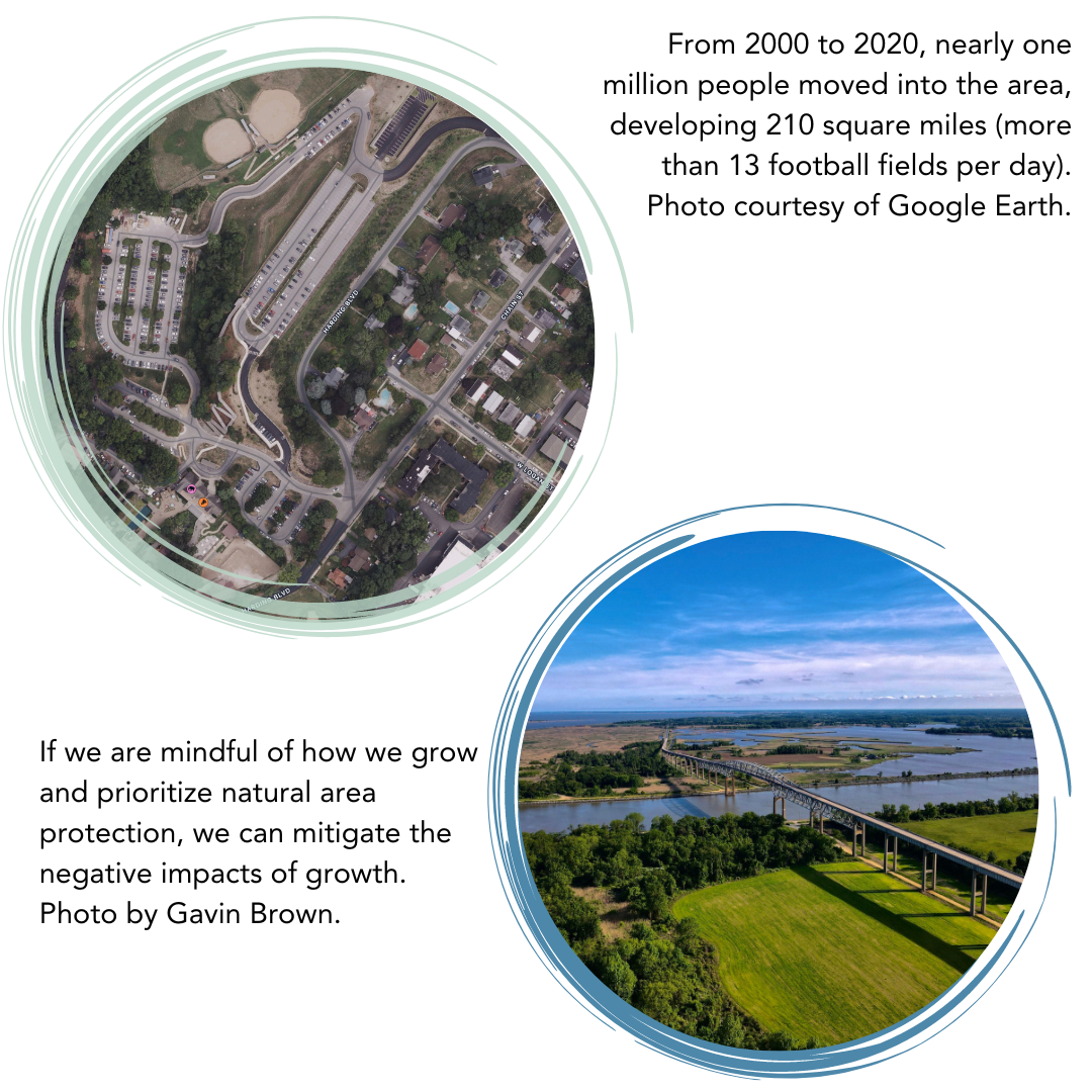
Our landscape is a patchwork of cityscapes, houses, farms, and lush forests. These landscapes tell a story of how our growing population has repurposed agricultural and natural lands to meet human needs. From 2000 to 2020, nearly one million people moved into the area, developing 210 square miles (more than 13 football fields per day). As we expand development to accommodate this increase in population, there can be consequences for native plants and animals, as well as amplified flooding. However, if we are mindful of how we grow and prioritize natural area protection, we can mitigate these negative growth impacts. This section explores how population changes affect our landscapes and their resilience to natural events.
Housing developments and human infrastructure, like roadways and bridges, cut through the natural landscape and harden surfaces that were once spongy, absorbent soil. When the ground is paved and covered, water cannot soak in. These covered areas are called impervious surfaces. When it rains, water moves quickly over pavement and picks up pollutants. Since the rainwater cannot soak into the ground, it gathers speed and rushes through our communities, and can end up as destructive, polluted flood waters. In addition to increased risk from flooding, development often displaces our native plants and animals and negatively impacts surrounding natural areas.
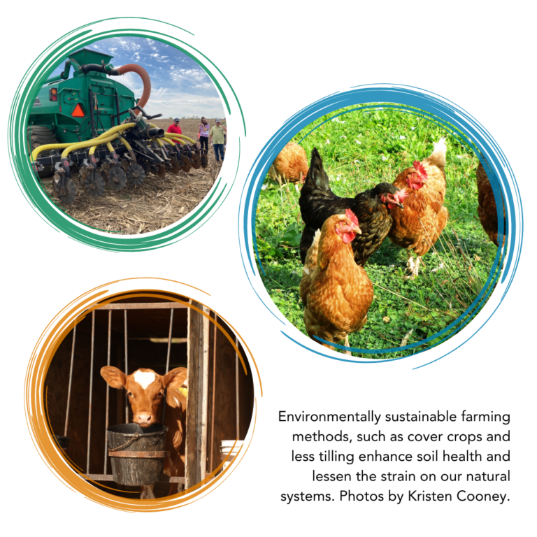
While farming is critical for food production, agricultural land use can also strain the health of our streams and watersheds. Farming methods like over-tilling, raising a lot of livestock in a small area, and overuse of fertilizer, pesticides, and herbicides can degrade water quality and soil health. It’s not all bad news, though. Environmentally sustainable farming methods, such as using cover crops and minimal tilling, enhance soil health and lessen the strain on our natural systems.
Natural lands like forests, meadows, marshes, and wetlands are vital systems. These areas work like natural sponges and filters, absorbing and cleaning rainwater before it reaches our rivers. In this way, natural lands protect us from floods. They also offer homes to plants and animals and serve as a space for outdoor recreation, among many other benefits.
As our population grows, we need more housing, community services, and infrastructure, which spurs development, often described as “development pressure.” Between 1996 and 2016, development claimed about 210 square miles of the Delaware River Watershed. During the same period, we lost about 106 square miles of farmland and 99 square miles of natural land. Reusing previously developed land for new construction reduces the need for undeveloped land.
How we use land directly influences our waterways and ecosystems, helping paint a picture of our environment’s health. With population on the rise, we’re likely to see further development. To keep the Delaware Estuary healthy, we must champion our natural areas and open spaces, protecting them from over-development. When we do develop, we need to do it wisely. Planting trees along streams and rivers and using permeable surfaces on our roads and sidewalks can help water soak into the ground and minimize runoff. By promoting sustainable regional planning and better coordination among governing bodies, we can ensure that the Delaware Estuary and Basin remains beautiful and healthy for future generations.

+Protect natural areas and open spaces.
+Support policies and initiatives that promote responsible development and agricultural preservation.
+Attend public meetings and contribute to public comment.
+Advocate for underserved communities so that development does not disproportionately affect them.
+Support local farms and businesses that prioritize sustainable practices.
What is Being Done?
Natural Lands works with communities in the region to encourage smart development that helps save an average of 62% of open space in new developments. Learn more here. The Pennsylvania Agricultural Conservation Easement Purchase Program enables state and county-level government to purchase conservation easements from farmers and protect prime farmland from future development developent. Pennsylvania leads the nation in the number of farms and acres permanently preserved for agricultural production. Learn more hereBuilding Connections:
How do changes in our region’s population and land use connect to the strategies and goals outlined in the Delaware Estuary Program’s Comprehensive Conservation and Management Plan (CCMP)? CCMP STRATEGY H1.4: Protect, enhance, and improve non-tidal wetlands CCMP STRATEGY H2.3: Protect and manage high-value and threatened forests for water quality This Population and Land Use indicator status report is based on research compiled in the 2022 Technical Report for the Delaware Estuary and Basin (2022 TREB). Please refer to this document for more information.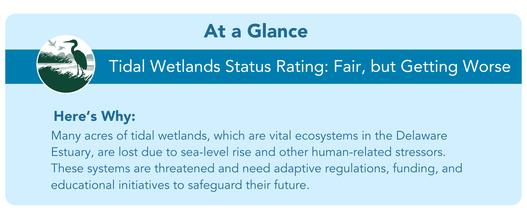

Why are nature’s critical buffers fading away, and how can we help protect them?
Tidal wetlands are one of the Delaware Estuary’s most important and characteristic habitats. They are ecological powerhouses that blur the boundaries between land and water and provide many benefits. Yet, the sad reality is they are being lost at accelerated rates in the Delaware Estuary due to rising sea levels and human-induced stressors such as development and nutrient overloading.
Wetlands are considered the kidneys of our waterways, helping to trap sediments, store carbon, and purify water. They are a place where fish and wildlife live, feed, and reproduce, making them crucial to their survival. However, rising sea levels and excessive human interference have strained these resilient ecosystems, resulting in significant degradation and loss. To safeguard the health of these habitats, we need to understand how they respond to threats and keep pace with rising sea levels to maintain their structure and function. This section discusses the importance of tidal wetlands, the threats they face, and potential strategies for safeguarding their future.
")
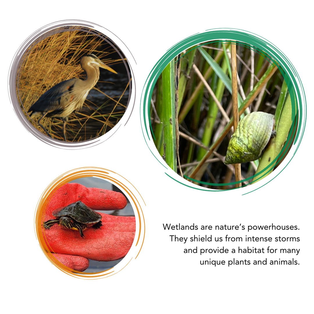
As nature’s powerhouses, tidal wetlands provide numerous ecosystem services including trapping sediments, storing carbon, and removing contaminants from the water. Wetlands shield communities from intense storms, and provide habitat and nesting areas for many unique plant and animal species. Home to a unique variety of plant species, and bound by frequent wet conditions with periodic tidal flooding, these wetlands are sculpted by sediments — tiny particles of minerals and decaying organic matter.
Sediments settle at the water’s bottom, forming a semi-solid substrate for plants to take root, while creating a habitat and home for turtles, herons, muskrats, fish, mollusks, and more. Unfortunately, these resilient ecosystems are facing compounding challenges. Rising sea levels and human-induced stressors such as development, and nutrient pollution, have led to significant losses in the Delaware Estuary’s tidal wetlands. Overstressed wetlands are more prone to degradation and erosion, undermining their resilience against climate change and sea-level rise which affects both humans and animals alike.
Understanding the looming threat of rising sea levels is critical for determining the fate of tidal wetlands in the Delaware Estuary. We lost more than 840 acres of tidal wetlands between 1996 and 2016. Models suggest that a sea level rise rate of 10 millimeters (mm) per year might be too much for tidal wetlands to keep pace with changing flood patterns.
Worst-case scenario models project a sea-level rise of 1.77 feet between 2000 and 2050 (10.8 mm/yr) and 6.56 feet between 2000 and 2100 (20 mm/yr) in the Delaware Estuary. This could culminate in a 14 percent loss of tidal wetlands by the year 2100.
If sea levels rise 3.28 feet by 2100, we could lose another 44,500 acres of wetland habitat over the next 80 years if nothing is done to slow these losses.
Ensuring the survival of our tidal wetlands will take adaptive regulations, substantial funding for research and restoration, and ongoing educational initiatives to enable communities to protect these vital ecosystems.
")
+ Learn about tidal wetlands, watersheds, climate change, stormwater runoff, and spread the word about these threatened ecosystems.
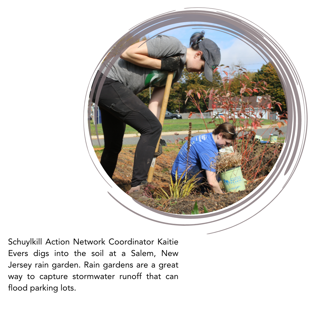
+ Plant native plants along the edges of water bodies and wetlands to reduce erosion (and associated wetland loss) from wind and wave action
+ Contribute to community science projects on apps like iNaturalist to help scientists better understand tidal wetland plant and animal species status.
+ Discourage and speak out against development projects that negatively impact tidal wetlands. For example, you can learn about proposed projects in PA that threaten wetlands and add public comments here.